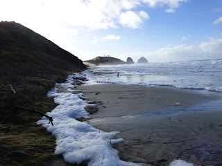
Looking north toward the rocky outcropping we photographed last time, there was only surf and foam all the way up to the foredune and cliffs. It was like that the entire length south to Cape Kiwanda.
 |
| Looking north |
 |
| Looking south |
The ocean had climbed the vegetated fore dune and eroded parts of the cliff itself.
But the most dramatic changes were at the foot of the sand dune (north side) at Cape Kiwanda. The ocean had reclaimed and repositioned much of the sand and more looks to be ready to fall.
The rocky cliff has also been scoured, leaving lots of rocks exposed where Black Turnstones were happily finding things to eat.
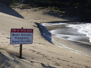
I'm not sure where this sign came from. It was on the dune at the foot of the cliff.
 |
| Looking north from cliff. The two signs still upright are in middle background. |
The tide was going out on our return hike, exposing more beach... and leaving lots of foam.
A heavy plastic pallet from Japan was beached on our way back.
Up in the parking lot was a log hunk twin to the two blocking the access road. I don't know if someone dragged it up there from the roadway or???


No comments:
Post a Comment