Saturday, December 26, 2015

Dec. 25, 2015, Mile 262

 On Christmas Day with a high tide prediction of 9.3 feet at 11:30 a.m., which is while we were there, we found a dramatically altered beach north of Cape Kiwanda. First of all, the access road at McPhillips Park was completely blocked with wood, kelp, and debris from some mighty wave that must have washed in recently.


 Looking north toward the rocky outcropping we photographed last time, there was only surf and foam all the way up to the foredune and cliffs. It was like that the entire length south to Cape Kiwanda.


Looking north


Looking south


The ocean had climbed the vegetated fore dune and eroded parts of the cliff itself.


 But the most dramatic changes were at the foot of the sand dune (north side) at Cape Kiwanda. The ocean had reclaimed and repositioned much of the sand and more looks to be ready to fall.


 The rocky cliff has also been scoured, leaving lots of rocks exposed where Black Turnstones were happily finding things to eat.


I'm not sure where this sign came from. It was on the dune at the foot of the cliff.


Looking north from cliff. The two signs still upright are in middle background.


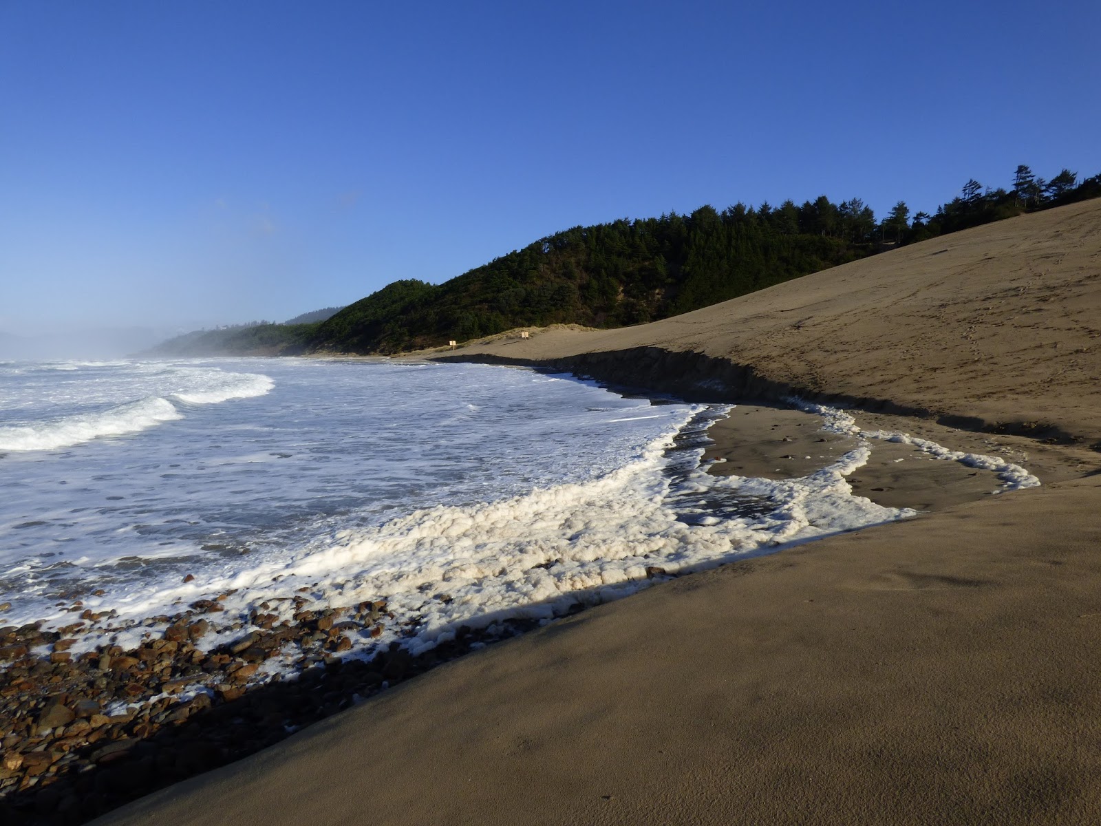
The tide was going out on our return hike, exposing more beach... and leaving lots of foam.


A heavy plastic pallet from Japan was beached on our way back.


Up in the parking lot was a log hunk twin to the two blocking the access road. I don't know if someone dragged it up there from the roadway or???


Wednesday, November 25, 2015

Nov. 25, 2015 Mile 262

Dead Sea Lion (?) washed up to bottom of access road at McPhillips Park
rock outcropping north of access road

looking north from McPhillips Park access road
looking south from McPhillips Park access road
We didn't know what this was... thought maybe some weird kind of seaweed, but the answer came from COASST: "At first glance, these look like skinny strands of fiber, but they're actually casings from cellophane tube worms! Cellophane tube worms, Spiochaetopterus costarum, live in tubes anchored in the sand just below the low-tide line and can be dislodged in heavy surf when the sand is moved around."


more cellophane tubeworm casings

lines of same stuff
looking north toward Cape Lookout in the distance

looking north toward Cape Lookout
looks man-made in the photo but seemed to be organic... and is evidently the tube worm casings before they start to deteriorate

recent bank erosion

continuing erosion of blocked off path
ocean foam on beach  (and vehicle tracks in area where vehicles are allowed)
vehicle tracks in area where vehicles not allowed (looking south)

vehicle tracks south of signs, prohibited area

vehicle tracks up the north side of Cape Kiwanda dune
eroding formation at north end of Cape Kiwanda
eroding bank at edge of dune
looking north toward Cape Lookout from north base of Cape Kiwanda, dune on right, signs forbidding vehicles in distance, center of photo
another area of bank erosion found on our return trip


dead bird wing... not sure of i.d, but think Red Phalarope.

We took out 2 big plastic bags of trash. Lots of people drive on and park close to the bank and picnic, drink, and some throw their bottles and trash there. Trash seems to attract trash so we are hoping when there are no other bottles/etc. in sight, people will take their trash with them. Hope springs eternal...